[ENG]
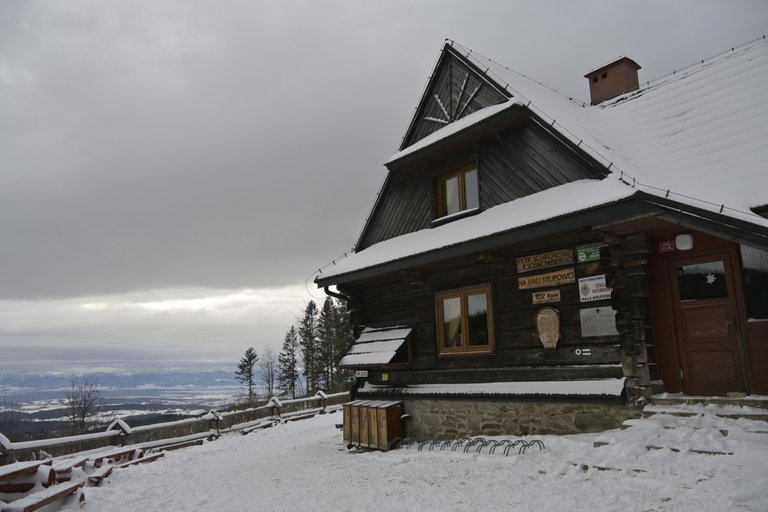
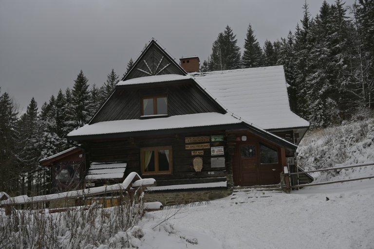
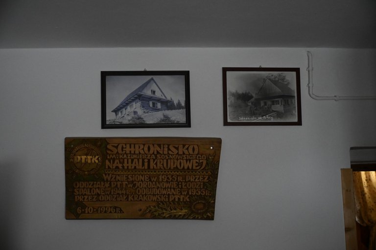
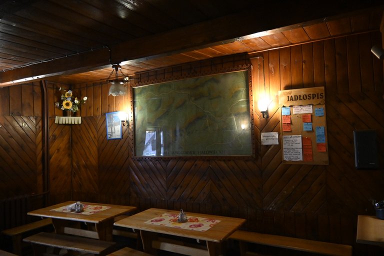
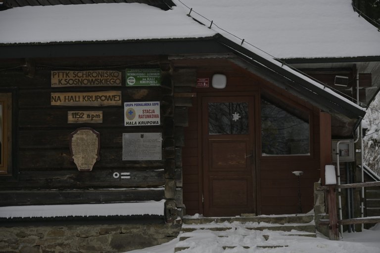
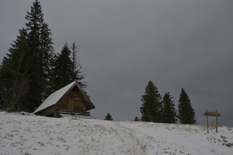
The tenth section of our march along the Main Beskid Trail began very pleasantly, because with a good night in the PTTK Shelter on Hala Krupowa. The previous day when we got there we were very cold, so we had no intention of staying up late in the evening in a common room, but went to sleep quite quickly. Thanks to this, we woke up early in the morning at dawn and when the kitchen in the shelter opened at 8 o'clock we were already packed, ready to go and waiting only for a sweet breakfast. One apple pie and one cheesecake set our morning so well that even the frost that reigned that day was not scary to us. The shelter itself stands out in relation to other Beskid shelters in that it has not had any major renovation for a very long time, so the standard prevailing there is a typical shelter standard, and not, as is increasingly the case, the standard of an elegant hotel located somewhere in the mountains. All I expect from mountain shelters is that they should be warm in winter, not too stuffy in summer, that there should be no bedbugs crawling on the mattresses, and that there should be apple pie and cocoa in the canteen. The Kazimierz Sosnowski PTTK shelter on Hala Krupowa met these basic requirements. It is located at an altitude of 1,152 meters above sea level and, contrary to what the name might wrongly suggest, it is not located on Hala Krupowa at all. What is more, you cannot even see Hala Krupowa from any of the windows in this shelter. The shelter is located at the western end of Hala Kucałowa, about 500 meters from Hala Krupowa, but why this shelter was wrongly named I have no idea. The first shelter, then called Shelter under the Police, was built in this place in 1935 and opened for use on December 16 of the same year. Unfortunately, the Nazis burned down the shelter on October 14, 1944, and its post-war reconstruction was not completed until October 9, 1955. The shelter owes its current condition to a thorough reconstruction at the turn of the 1980s and 1990s, which by Polish standards makes it a rather outdated facility, but full of charm.
[PL]
Dziesiąty odcinek naszego marszu po Głównym Szlaku Beskidzkim zaczął się bardzo przyjemnie, bo od dobrej nocy w Schronisku PTTK na Hali Krupowej. Poprzedniego dnia gdy tam dotarliśmy byliśmy bardzo przemarznięci, przez co kompletnie nie w głowach było nam długie siedzenie do późnych godzin wieczornych na wspólnej sali, tylko dość szybko poszliśmy spać. Dzięki temu rano wstaliśmy wcześnie skoro świt i gdy w schronisku została otwarta kuchnia o godzinie 8 my biliśmy już spakowani, gotowi do wyjścia i czekaliśmy wyłącznie na słodkie śniadanie. Jedna szarlotka i jeden sernik, ustawiły nasz poranek tak dobrze, że nawet panujący tego dnia mróz nie był nam straszny.
Schronisko samo w sobie wyróżnia się w odniesieniu do innych beskidzkich schronisk tym, że nie miało żadnego większego remontu już od bardzo dawna, dlatego standard w nim panujący jest standardem typowo schroniskowym, a nie jak ma to miejsce coraz częściej standardem typu elegancki hotel położony gdzieś w górach. Od górskich schronisk oczekuje tylko tego, aby w zimie było w nim ciepło, w lecie nie było za duszno, na materacach nie chodziły pluskwy, a w stołówce była szarlotka i kakao. Schronisko PTTK im. Kazimierza Sosnowskiego na Hali Krupowej spełniało te podstawowe wymagania. Położone jest ono na wysokości 1152 metrów nad poziomem morza i wbrew temu co mogłaby błędnie sugerować nazwa wcale nie leży na Hali Krupowej. Co więcej, z żadnego okna w tym schronisku nie widać nawet Hali Krupowej. Schronisko znajduje się przy zachodnim krańcu Hali Kucałowej oddalonej o około 500 metrów od hali Krupowej, ale dlaczego ta mylnie nazwano to schronisko nie mam pojęcia. Pierwsze schronisko zwane wówczas Schroniskiem pod Policą zbudowano w tym miejscu w roku 1935 i oddano do użytkowania 16 grudnia tego samego roku. Niestety Hitlerowcy spalili schronisko 14 października 1944 a jego powojenna odbudowa zakończyła się dopiero 9 października 1955. Obecny stan schronisko zawdzięcza gruntownej przebudowie z przełomu lat osiemdziesiątych i dziewięćdziesiątych minionego wieku, co jak na polskie standardy faktycznie czyni je dość przestarzałym obiektem, ale za to pełnym uroku.
[ENG]
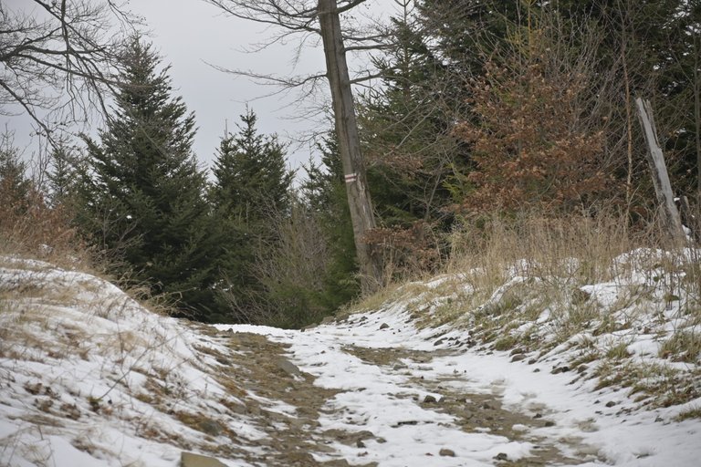
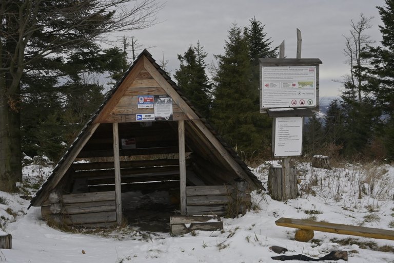
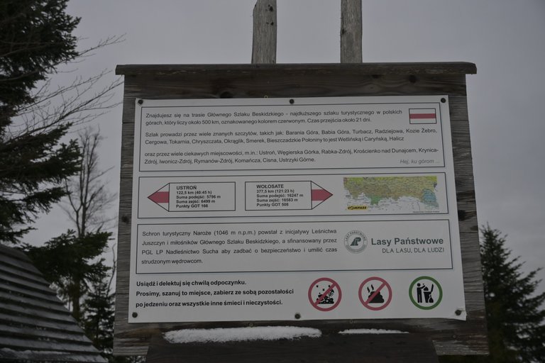
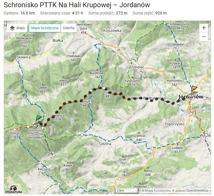
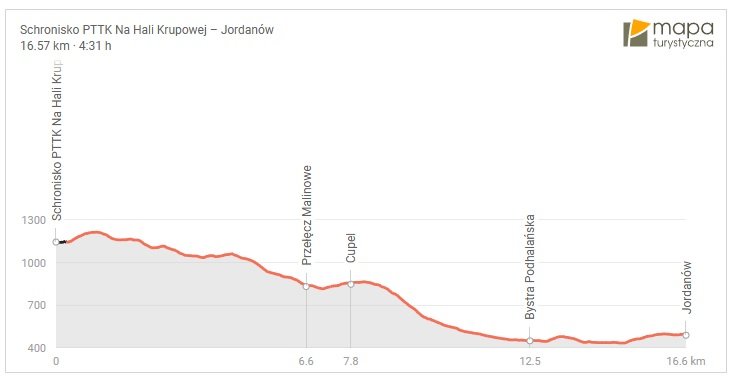
After getting on the trail and walking about 500 meters, we started to hear a strange, loud, low whistle. With each step, the whistle became louder. Only after reaching the foot of Okrąglica Mountain did it turn out that this strange whistle was coming from the force of gusts of gusty wind against the top of the radio mast standing at the top of the mountain. Only after about ten minutes of walking down the slope of Okrąglica did the noise stop. We were very lucky that day, because our entire route led on a very gentle slope straight down. Thanks to this, we hardly felt tired at all, so the tourist shelter that we passed in a place called Naroże was not necessary for us at all, but we noted this place to remember it for the future, because taking a break in such a place and organizing, for example, a bonfire there is a great idea for future hikes in the Beskids.
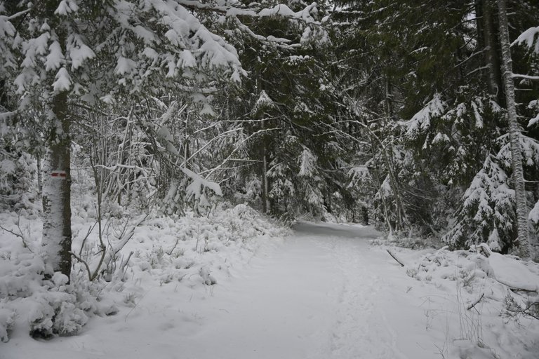
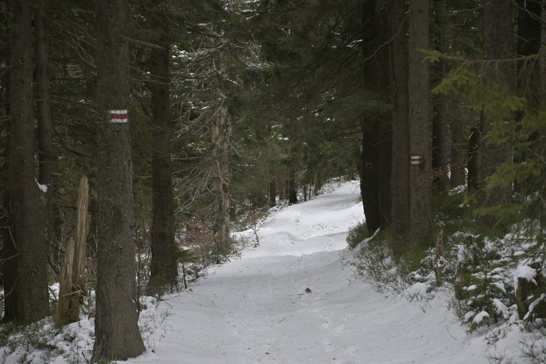
Another characteristic point on our route was the Malionwe Pass, which is located at an altitude of 839 meters above sea level. There was a small monument there commemorating the fights of the Home Army partisans against the Nazis that took place in the local forests. Unfortunately, this was where the steep descent to Bystra Podhalańska began, and because the lower we went, the temperature was getting higher and higher, and therefore the snow lying on the trail was becoming thinner in favor of the mud that appeared on the trail. Fortunately, two kilometers before Bystra Podhalańska, the mountain trail became a dirt road, on which there was no longer so much mud. From Bystra to Jordanów, most of the route led us along a very nice path marked out between the edge of the forest and the railway line leading to Zakopane. Unfortunately, although we walked along the tracks for at least 20 minutes, no train passed, which was a shame, because it was an exceptionally picturesque section. After reaching Jordanów, we were in for an unpleasant surprise, because it turned out that the bus timetable found on the Internet was different from the one posted at the bus stop and actually in effect in Jordanów. Because of this, our return to Krakow was delayed by at least an hour, because we had to take a different bus with a change in Rabka. Such are the joys of using public transport.
[PL]
Po wyjściu na szlak i przejściu około 500 metrów zaczęliśmy słyszeć dziwny głośny niski świst. Z każdym krokiem świst stawał się głośniejszy. Dopiero po dotarciu do podnóża góry Okrąglicy okazało się, że ten dziwny świst to pochodził z mocy podmuchów porywistego wiatru o szczyt masztu radiowego stojącego na szczycie góry. Dopiero po około dziesięciu minutach marszu w dół po zboczu Okręglicy hałas ucichł. Tego dnia mieliśmy dużo szczęścia, bo cała nasza droga prowadziła bardzo łagodnym pochyleniem prosto w dół. Dzięki temu nie odczuwaliśmy prawie wcale zmęczenia, dlatego Schron turystyczny, który minęliśmy w miejscu zwanym Naroże wcale nie był nam potrzebny, natomiast zanotowaliśmy sobie to miejsce, aby pamiętać o nim na przyszłość, bo zrobienie sobie przerwy w takim miejscu i zorganizowanie tam np. ogniska to piękny pomysł na przyszłe wędrówki po Beskidach.
Kolejny charakterystyczny punkt na naszej trasie była Przełęcz Malionwe, która znajduje się na wysokości 839 metrów nad poziomem morza. Stał tam mały pomnik upamiętniający walki partyzantów Armii Krajowej hitlerowcami które miały miejsce w tutejszych lasach. Niestety w tym miejscu zaczął się etap stromego schodzenia do Bystrej Podhalańska, a ponieważ im niżej schodziliśmy temperatura stawała się coraz wyższa, a tym samym śnieg leżący na szlaku stawał się coraz rzadszy na rzecz pojawiającego się na szlaku błota. Całe szczęście jeszcze na dwa kilometry przed Bystrą Podhalańską szlak górski stał się drogą gruntową, na której nie było już tak wiele błota. Od Bystrej, do Jordanowa większość trasy wiodła nas po bardzo fajnej ścieżce wytyczonej między krawędzią lasu, a linia kolejową prowadzącą do Zakopanego. Niestety mimo że szliśmy wzdłuż torów przez co najmniej 20 minut, żaden pociąg nie przejechał, a szkoda, bo był to wyjątkowo malowniczy odcinek. Po dojściu do Jordanowa czekała nas niemiła niespodzianka, ponieważ okazało się, że rozkład jazdy autobusów znajdujący się w Internecie, różni się od tego który wisi na przystanku autobusowym i realnie funkcjonuje w Jordanowie. Z tego powodu nasz powrót do Krakowa opóźnił się o przynajmniej godzinę, ponieważ musieliśmy jechać innym autobusem z przesiadką w Rabce. Takie są uroki korzystania z autobusowej komunikacji zbiorowej.
