Hello everyone!
Another post about Corsica. It's great because our Worldmappin of Corsica is getting more and more complete.
Today, I'd like to share our adventure in the Calanques of Piana. It's a hike we found on the Internet and it was supposed to be easy... but things didn't go quite as planned! 😊
You should know that whenever we choose a hike online, we tend to overestimate our abilities. It's probably an ego thing. But it also makes for great memories.
The Calanques of Piana? 🌅
Located on the west coast of Corsica (as you can see on Worldmappin), the calanques are one of the most spectacular natural gems of the island.
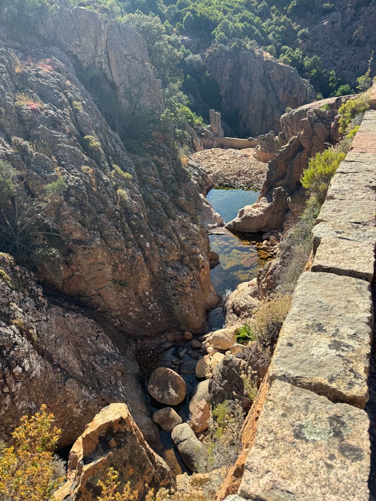
On numerous forums, websites, and especially on social media, they are known for their red granite rock formations. These calanques plunge abruptly into the Mediterranean Sea.
According to my friend Google, the rock formations of the Calanques of Piana are the result of erosion over millennia. This erosion has created natural sculptures, some with astonishing shapes. Among the most famous is "the heart of Piana," a heart-shaped formation visible from the hiking trail. We'll talk about it more below.
The Hike 🚶
Our day began with a 1h20 drive from our gîte.

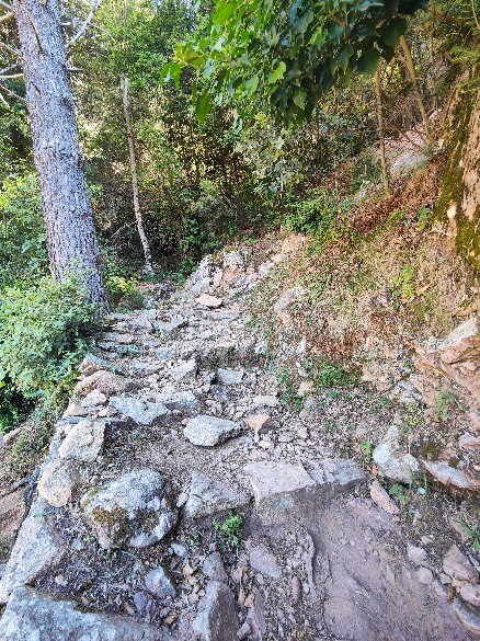
A small problem, we didn't set the correct GPS point for the start of the hike. As a result, we started the hike in the wrong direction. At first, we were a bit disconcerted seeing the steep climb that awaited us among the rocks. But in the end, it was a blessing in disguise; we actually started with the most difficult part.
This part involved climbing a sort of staircase to gain an additional 250 meters in elevation. So a positive elevation gain of 250 meters over a very short period.
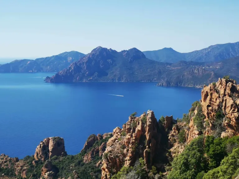
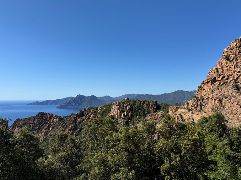
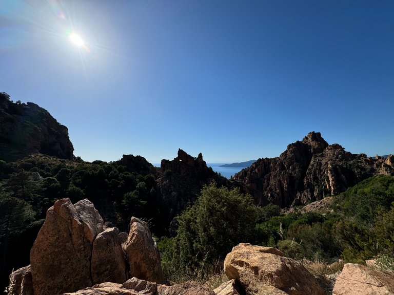
At the top, out of breath, we were rewarded with a view that took our breath away even more:

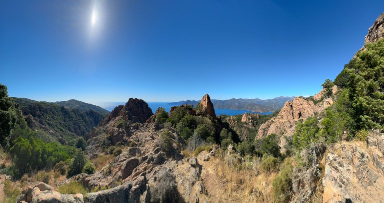
The contrast between the red rocks and the blue sea creates a palette of colors that I couldn't quite capture with my phone. However, I thought of @fotostef. He would have managed to capture all the nuances.
The sun was blazing. We had planned to leave early in the morning but found ourselves up there at 2 PM after a festive night.
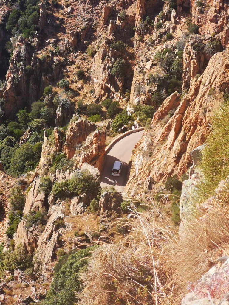
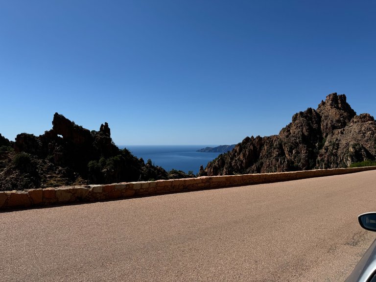
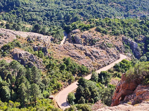
From up there, we could better see the winding roads below. It's worth noting that in peak season, many tourist buses travel these roads.
In a car, you’d better not meet them.
From up there, we could also better see the boats on the Mediterranean which, like shooting stars, left behind a white trail:

Here's a cute little van:
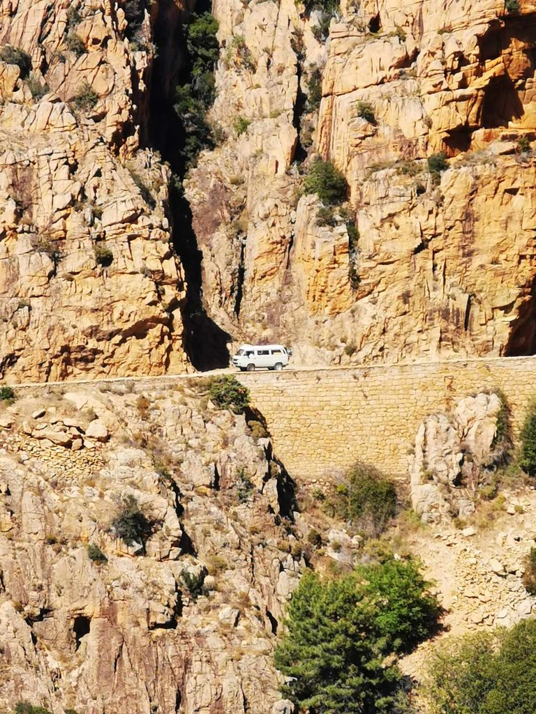
It reminded us that ours was patiently waiting for us at our parents' house. But no regrets because with its engine and size, it would be very difficult for us to drive in Corsica.

@altheana and me <3
At every step we took, we had to take a photo. The hike, announced to take 1h30, ended up taking 3 hours.
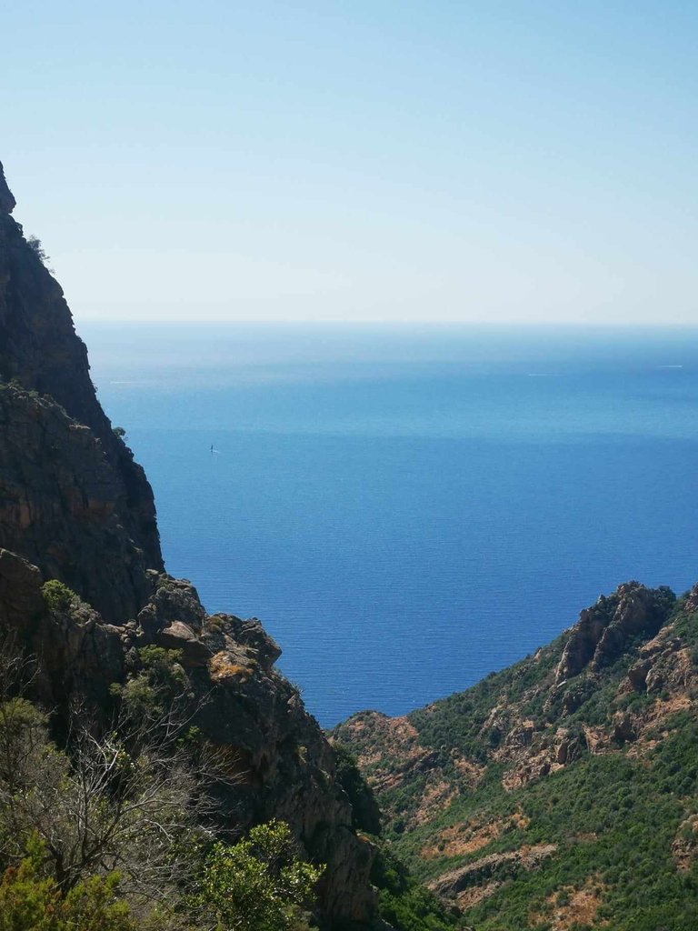
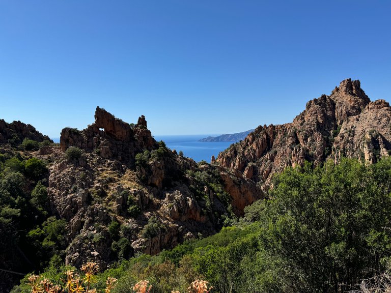
Here, you can clearly see the rock plunging abruptly into the sea.
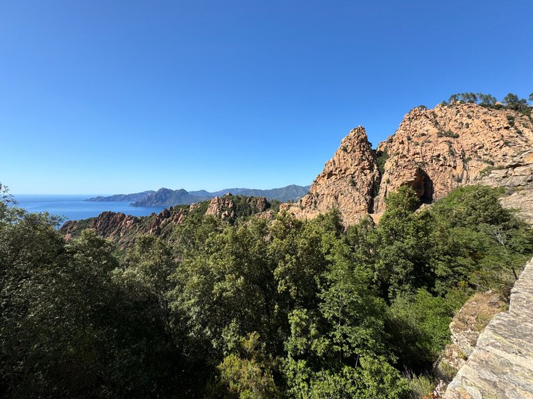
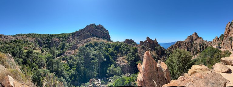
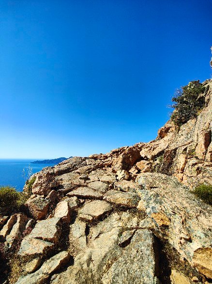
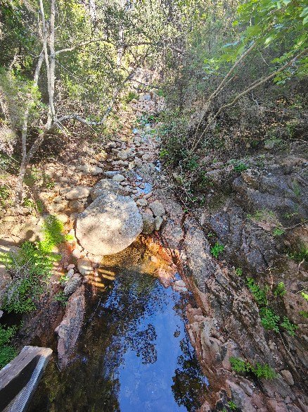
To talk a bit about the path itself, it was pleasant to take. It’s a fairly family-friendly trail. A large part of it runs along the mountainside, offering an unobstructed view of the calanques:

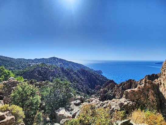
And when we didn't have a view of the Calanques, we had a view of Cargèse or the road:
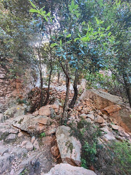
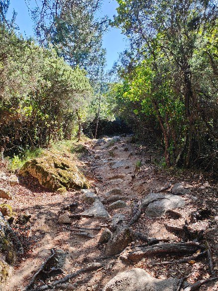
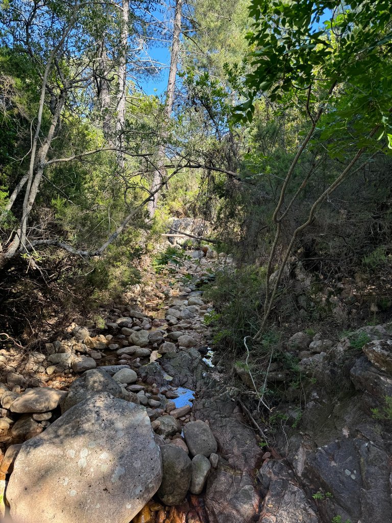
Then, the path delves slightly inland. Here, the eyes rest while the nose awakens, captivated by the scents of the maquis:
Finally, the return path takes the road. In high season, this would have been a negative point given the danger of the road.
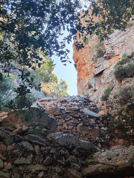
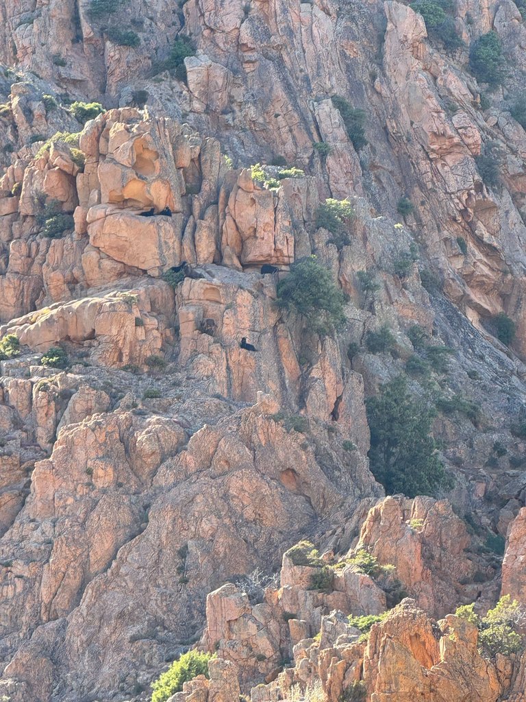
But for us, there was no one. It was an opportunity to enjoy the "Heart of Piana."
Can't see it? Let me help you:

And to end on a high note, a herd of wild goats:
Did you enjoy this post? Feel free to start a discussion in the comments section!
Some photos are blurrier than others. Here's why: I recently changed phones. Before selling my old one, I backed up my photos. But in the rush, I mixed up the folders and only downloaded the thumbnails.
The English translation is done with DeepL.
Version Française
Bonjour à tous !
Encore une publication sur la Corse. C'est bien, car le Worldmappin de la Corse commence à être de plus en plus fourni.
Aujourd'hui, c'est notre aventure dans les Calanques de Piana que je voudrais vous partager. C'est une balade que nous avions trouvée sur Internet et qui était censée être facile... mais les choses ne se sont pas passées tout à fait comme prévu ! 😊
Il faut savoir que dès que nous choisissons une randonnée sur Internet, on sur-estime un peu nos compétences. C'est probablement une histoire d'égo. Mais ça fait aussi de très bon souvenir.
Les Calanques de Piana ? 🌅
Situées sur la côte ouest de la Corse (comme vous pouvez le voir sur Woldmappin), les calanques sont l'un des joyaux naturels les plus spectaculaires de l'île.
Sur les nombreux forums, sites internet et surtout, sur les réseaux sociaux, elles sont connues pour leurs formations rocheuses en granit rouge. Ces calanques plongent abruptement la mer Méditerranée.
Toujours d'après mon ami Google, les formations rocheuses des calanques de Piana sont le résultat de l'érosion au fil des millénaires. Cette érosion à créé des sculptures naturelles. Certaines aux formes étonnantes. Parmi les plus célèbres, on trouve "le coeur de Piana". Une formation en forme de cœur visible depuis le sentier de randonnée. On en reparlera plus bas.
La randonnée 🚶
Notre journée a commencé avec un trajet en voiture de 1h20 depuis notre gîte.
Petit souci, nous n'avions pas mis le bon point GPS pour le début de la randonnée. Résultat : nous avons commencé la rando dans le mauvais sens. Au début, nous étions un peu déconcertés en voyant la très grosse montée qui nous attendait entre les roches. Mais finalement, c'était une chance déguisée ; nous avons en réalité commencé par la partie la plus difficile.
Cette partie consistait à monter une sorte d'escalier pour s'élever de 250m supplémentaire. Donc un dénivelé positif de 250m sur une très courte période.
Arrivé en haut, à bout de souffle, nous avons récompensé par la vue. Vue qui nous a davantage coupé le souffle :
Le contraste entre les roches rouges et la mer bleue crée une palette de couleurs que j'ai été incapable de prendre avec mon téléphone. Cela dit, j'ai pensé à @fotostef. Lui aurait réussi à en saisir toutes les nuances.
Le soleil tapait fort. Nous avions prévu de partir tôt le matin. Et nous nous sommes finalement retrouvés là-haut à 14h, suite à une nuit festive.
De là-haut, on voyait mieux les routes sinueuses en contrebas. Il faut savoir qu'à la haute saison, de nombreux cars transportant des touristes passent sur ces routes.
En voiture, mieux vaut ne pas les croiser.
De là-haut, nous pouvions aussi mieux voir les bateaux sur la Méditerranées qui, comment des étoiles filantes laissaient derrière eux une traînée blanche :
Voici un petit van sympa :
Il nous a rappelé que le nôtre nous attend sagement chez nos parents. Mais sans regret car son moteur et sa taille, il serait très difficile pour nous de conduire en Corse.
@altheana et moi <3
A chaque pas que nous faisions, nous devions prendre une photo. La randonnée, annoncée pour 1h30, en faisait finalement 3h.
Ici, on peut très clairement voir la roche qui se jette abruptement dans la mer.
Pour parler un peu du chemin en lui même, il était agréable à prendre. C'est un tracé finalement assez familial. Une grosse partie se fait à flanc de montagne, laissant une vue dégagée sur les calanques :
Et quand nous n'avons pas une vue sur les Calanques, nous avons une vue sur Cargèse ou sur la route :
Puis, le chemin s'enfonce légèrement dans les terres. Ici, les yeux se reposent tandis que le nez s'éveille. Captivé par les senteurs du maquis :
Enfin, le chemin du retour se fait sur la route. En haute saison, ça aurait été un point négatif au vue de la dangerosité de la route.
Mais en ce qui nous concerne, il n'y avait personne. L'occasion pour nous de profiter du "Cœur de Piana".
Vous ne le voyez pas ? Laissez-moi vous aider :
Et pour finir en beauté, un troupeau de chèvres sauvages :
Cette publication vous a plu ? N'hésitez pas à engager la discussion dans l'espace commentaires !
Certaines photos sont plus floues que d'autres. La raison est la suivante : j'ai récemment changé de téléphone. Avant de revendre mon ancien appareil, j'ai fait une sauvegarde de mes photos. Mais dans la précipitation, je me suis trompé de dossier et n'ai téléchargé que les miniatures.
La traduction Anglaise est faite avec DeepL.