ENGLISH VERSION
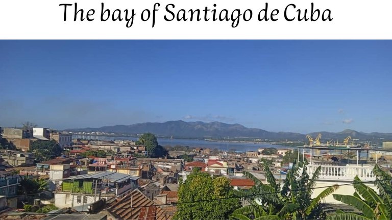
Hello #Pinmapple community, this is the first time I publish in this community and today I want to tell you about a recent trip I made to the bay of Santiago de Cuba, a very busy area.
Today I want to tell you a little about the history of the bay of Santiago de Cuba.
Considered among the typical pocket or bottleneck bays, located in the province of Santiago de Cuba. The city of the same name, located southwest of the bay, and the port that operates there are the second most important in Cuba. It is a multipurpose port, with export, import and cabotage activity for general and special cargo.
It was discovered by Christopher Columbus in 1494, during his second voyage, in its surroundings the cities of Santiago del Prado (today known as El Cobre) and Santiago de Cuba were founded, the second city in Cuba due to its size economic activity. It was founded by Diego Velázquez de Cuéllar in 1514.
This town was the first in importance in the largest of the Antilles until the mid-17th century and the first colonial expeditions to Mexico and Florida departed from its protective bay.
It became the center of the commercial movement that brought prosperity to the city, the starting point for conquest expeditions to Central America and from as early as 1521 it received ships from Haiti first and then directly from Africa loaded with slaves.
It is located on the southern coast of Cuba, facing the Caribbean Sea, 110 miles west of Punta de Maisí, on the southeastern coast, belonging to the province of Santiago de Cuba.
The total area of the bay is 11.9 km; with a coastal perimeter including its keys of 41.35 kilometers. It has a maximum length of 8.5 km, the widest part of the bay is the central area from the Frank País mill to Punta Sal north of the Hermanos Díaz oil refinery, which is 2 km, while the widest part It is narrow in the entrance channel with 225 meters wide, and a depth between 8.8 and 13.7 m. Its bottom is made of stones and sand.
The shape, width and depth of its entrance channel have given rise to regulations regarding the dimensions of ships for access to the port.
It constitutes a deep inlet of the sea, on a straight and cliffed coast that barely leaves a narrow communication channel with the sea. It is bordered mainly by eruptive rocks, with scrub and grassland vegetation.
Surrounded by the mountains of the Sierra Maestra, this marine enclave is sheltered from winds and swells in all directions, its coasts are cliffs and the waves of the sea penetrate into them, forming coves and inlets, being among the most important on the east coast. from the entrance channel: Caleta Estrella and the Níspero, Gaspar, Carviza and la Cruz inlets; in the western part, the Cabañitas, Don Tomás, Cajuma, Victorino, Presidio and Julián coves; In the north and northwest is the wide Miradero cove, with depths ranging between 1.1 and 1.5m in the center and more than a meter in other parts, as well as the Morrillo, Socapa, Gorda, Nicola, Sol, Duan and Limeta points.
In the entrance channel, to the north of the mouth, there is Granma Cay with numerous buildings and in the middle part of the bay, close to the 20th parallel, Cayo Ratones.
The Cobre (name that refers to the rich deposits of this metal in Santiago de Cuba), Guaos, Yarayó as well as the Yarto or Trocha drainage discharge their waters into the bay. The fact that the basin is enclosed in a gigantic depression or hole makes the temperature very high as it does not directly receive the influence of the trade winds or sea breezes, for this reason Santiago de Cuba is the region with the highest temperature. annual average.
In the years of the neocolony in the bay, wealthy families built rest houses around the coast; in La Socapa, Ciudamar and Cayo Smith.
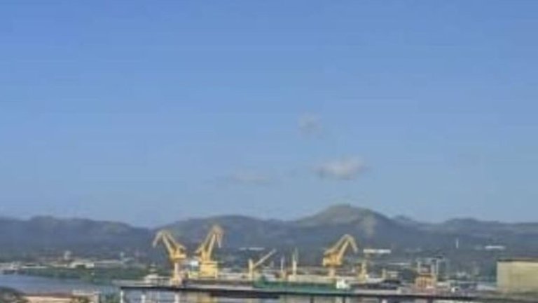
With continuous demographic growth, different industries were built, such as:
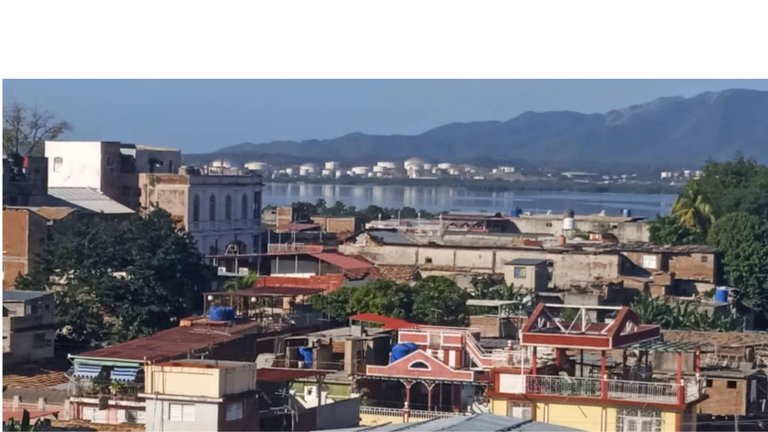
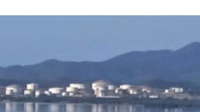
Hermanos Díaz Oil Refinery
Antonio Maceo Thermoelectric Plant
José Merce Cement Factory
Molinera Frank País García.
Combined Porcine Genetic.
Astilleros del Oriente ASTOR.
DAMEX Shipyards.
Military hospital.
Puerto Guillermón Moncada.
Edible Oil Processing Plant
Cuba Rum and Distillery.
Hatuey Beer Factory.
Asbestos Cement Factory.
Combined Los Guaos 1 and 2.
Textile manufacturer Celia Sánchez Manduley
Santiago Refrigerator No.1
Ambrosio Grillo Hospital.
Local Industries.
Railway Workshops.
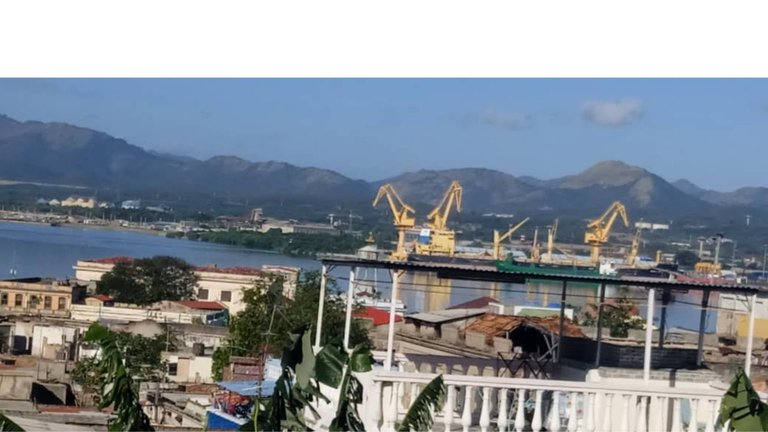
The growth of the city, based on its margins, has left its effect felt over the years. One of the main aspects of economic development contemplates the increase in port activity primarily in the commercial area, for this there are six anchorages for ships:
Fat tip.
NE of Cayo Ratones.
E for Punta del Sol.
NW of Bajo de los Compadres.
ENE Pier Antonio Maceo.
The Bay of Santiago de Cuba has been subject to great pressures as a result of human and industrial activity, which is why the Eastern Center for Ecosystems and Biodiversity (BIOECO) and the Center for Multidisciplinary Studies of Coastal Zones, of the University of Oriente ( CEMZOC), develop environmental education projects in the surrounding towns, aimed at raising awareness among the residents of the communities located on the coast of Santiago Bay, constituting a step forward in the actions that are developed for the sanitation, protection and preservation of this great environment.
That's it for my post, I hope you like it as much as I do, and I just need to invite you to leave your nice comments and wish you a happy day.😘🥰❤
For more un formation you can visit Ecured
The photos were taken from my Samsung Galaxi A03 Core phone and edited from Canva and translated by Deepl
VERSIÓN en Español<p Hola comunidad de #Pinmapple, está es la primera vez que publico en esta comunidad y hoy quiero contarle sobre un reciente viaje que hice a la bahía de Santiago de Cuba una zona de mucha afluencia
. Hoy quiero contarles un poco sobre la historia de la bahía de Santiago de Cuba .
Considerada entre las típicas bahías de bolsa o cuello de botella, ubicada en la provincia de Santiago de Cuba. La ciudad de igual nombre, ubicada al suroeste de la bahía, y el puerto que allí opera son los segundos en importancia en Cuba. Es un puerto multipropósito, con actividad de exportación, importación y cabotaje de carga general y especial.
Fue descubierta por Cristóbal Colón en 1494, durante su segundo viaje, en su entorno se fundaron las ciudades de Santiago del Prado (hoy conocida como El Cobre) y Santiago de Cuba está última , la segunda ciudad de Cuba por su tamaño actividad económica, fue fundada por Diego Velázquez de Cuéllar en 1514 .
Esta villa fue la primera en importancia de la mayor de las antillas hasta mediados de el siglo XVl y de su protectora bahía partieron las primeras expediciones coloniales hacia México y la Florida.
Se convirtió en el centro del movimiento comercial que traía prosperidad a la ciudad, el punto de partida de expediciones de conquistas a la América Central y desde fecha tan temprana como 1521 recibía buques procedentes de Haití primero y directamente de África después cargados de esclavos
Esta situada en la costa meridional de Cuba, frente al mar Caribe, a 110 millas al oeste de Punta de Maisí, en la costa suroriental, perteneciente a la provincia de Santiago de Cuba.
La superficie total de la bahía es de 11.9 km; con un perímetro del litoral incluyendo sus cayos de 41,35 Kilómetros. Tiene un largo máximo de 8,5 Km, la parte más ancha de la bahía es la zona central desde la molinera Frank País hasta Punta Sal al norte de la refinería de petróleo Hermanos Díaz la cual tiene 2 Km., mientras que la parte más estrecha está en el canal de entrada con 225 metros de ancho, y una profundidad entre 8.8 y 13.7 m. Su fondo es de piedras y arena.
La forma, ancho y profundidad de su canal de entrada han originado regulaciones en cuanto a las dimensiones de los buques para su acceso al puerto.
Constituye un profundo entrante del mar, en una costa rectilínea y acantilada que apenas deja un estrecho canal de comunicación con el mar. Se encuentra bordeada principalmente por rocas eruptivas, con una vegetación de matorral y herbazales.
Rodeada por las montañas de la Sierra Maestra ese enclave marino se encuentra abrigado de vientos y marejadas en todas las direcciones, sus costas son acantiladas y en ellas las olas del mar penetran formando caletas y ensenadas, figurando entre los más importantes en la costa este del canal de entrada: la Caleta Estrella y las ensenadas Níspero, Gaspar, Carviza y la Cruz; en la parte oeste, las ensenadas Cabañitas, Don Tomás, Cajuma, Victorino, Presidio y Julián; en el norte y noroeste se encuentra la amplia ensenada del Miradero, con profundidades que oscilan entre 1.1 y 1.5m en el centro y más de un metro en otras partes, así las puntas Morrillo, Socapa, Gorda, Nicola, Sol, Duan y Limeta.
En el canal de entrada, al norte de la boca se haya cayo Granma con numerosas construcciones y en la parte media de la bahía, próximo al paralelo 20, Cayo Ratones.
En la bahía descargan sus aguas los ríos Cobre (nombre que hace referencia a los ricos yacimientos de este metal en Santiago de Cuba), Guaos, Yarayó así como el drenaje Yarto o Trocha. El hecho de que la cuenca este encajonada en una gigantesca depresión u hoyo hace que la temperatura sea muy elevada al no recibir directamente la influencia de los vientos alisios, ni las brisas marinas, por esta razón Santiago de Cuba es la región de más alta temperatura media anual.
En los años de la neocolonia en la bahía las familias adineradas construyeron casas de descanso, en los alrededores de las costas; en La Socapa, Ciudamar y Cayo Smith.
Con el continuo crecimiento demográfico se construyeron diferentes industrias, como:
Refinería de Petróleo Hermanos Díaz
Termoeléctrica Antonio Maceo
Fábrica de Cemento José Merce
Molinera Frank País García.
Combinado Genético Porcino.
Astilleros del Oriente ASTOR.
Astilleros DAMEX.
Hospital Militar.
Puerto Guillermón Moncada.
Planta Procesadora de Aceites Comestibles
Cuba Ron y Destilería.
Fábrica de Cervezas Hatuey.
Fábrica de Asbesto Cemento.
Combinado Los Guaos 1 y 2.
Textilera Celia Sánchez Manduley
Frigorífico Santiago No.1
Hospital Ambrosio Grillo.
Industrias Locales.
Talleres del Ferrocarril.
El crecimiento de la ciudad, asentada en sus márgenes ha dejado sentir su efecto en el transcurso de los años. Unos de los aspectos principales del desarrollo económico contempla el incremento de la actividad portuaria primordialmente en el renglón comercial, para ello existen seis fondeaderos para buques:
Punta Gorda.
NE de Cayo Ratones.
E de Punta del Sol.
NW del Bajo de los Compadres.
ENE Espigón Antonio Maceo.
La Bahía de Santiago de Cuba ha sido objeto de grandes presiones producto de la actividad humana e industrial, es por ello que el Centro Oriental de Ecosistemas y Biodiversidad (BIOECO) y el Centro de Estudios Multidisciplinarios de Zonas Costeras, de la Universidad de Oriente (CEMZOC), desarrollan proyectos de educación ambiental en las localidades aledañas, encaminado a concientizar a los pobladores de las comunidades ubicadas en el litoral de la bahía santiaguera, constituyendo un paso de avance en las acciones que se desarrollan por el saneamiento, protección y preservación de este gran entorno.
Hasta aquí mi post espero que les guste tanto como a mi y ,solo me falta invitarlos a dejarles sus lindos comentarios y desearles un feliz día.😘🥰❤
Las fotos fueron tomadas desde mi teléfono Samsung Galaxi A03 Core y editadas desde Canva y traducido por Deepl
</