Hi!/Cześć!
ENG:
Today, I’d like to share a post about my trip to Kyrgyzstan. First off, I want to apologize for the poor quality of the photos. Unfortunately, due to baggage limitations and the fact that my trip wasn’t strictly tourism or photography-focused, I had to rely on a cheap lens and my phone for most of the shots.
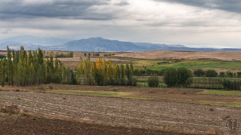
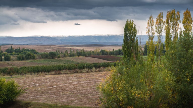
The area I traveled through was the Fergana Valley, located in the southwestern part of Kyrgyzstan. It’s surrounded by mountains, with the Tien Shan range to the north and the Alay Mountains to the south. The valley spans across Kyrgyzstan, Uzbekistan, and Tajikistan. This region has been used for agriculture since ancient times, and it still remains a major farming area today. Just like in ancient times, the valley is crisscrossed by many irrigation canals that water the surrounding fields. They grow crops like wheat, cotton, and rice here.
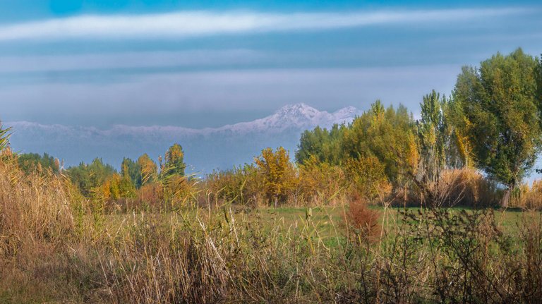
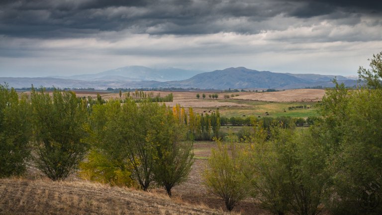
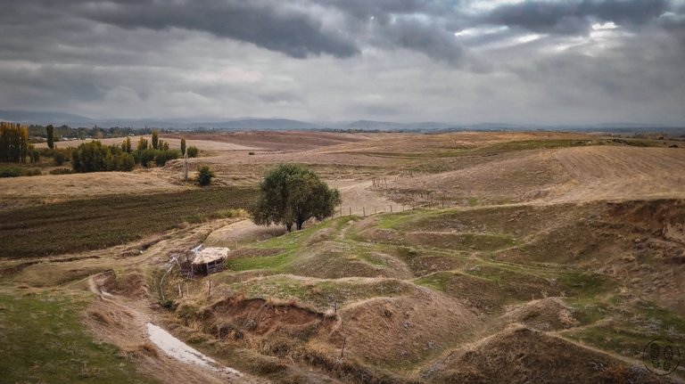
I hope I managed to capture the diverse landscape of the valley in my photos, where cultivated fields blend into steppes, with snow-capped mountain peaks towering in the background. Unfortunately, the weather wasn’t very kind, and for several days, the steppe was covered in fog and low-hanging clouds, which completely hid the mountains surrounding the valley.
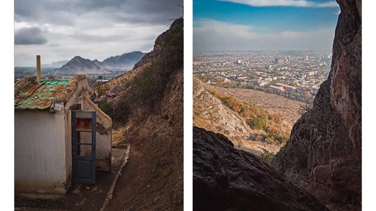
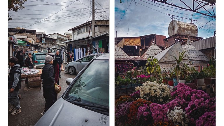
The largest urban center in the Kyrgyz part of the Fergana Valley is the city of Osh. I spent some time there, and although I’m not usually a fan of big cities, I really enjoy the atmosphere of markets and bazaars, and Osh didn’t disappoint in that regard. There’s a large market spread out on both sides of the Ak-Buura River, which runs through the city.
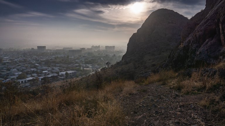
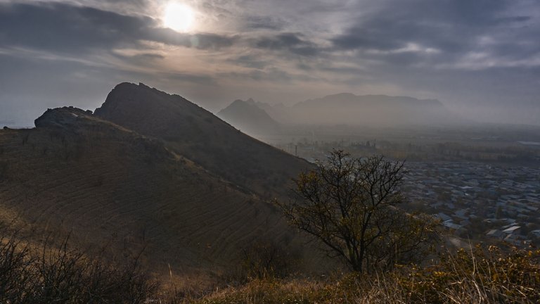
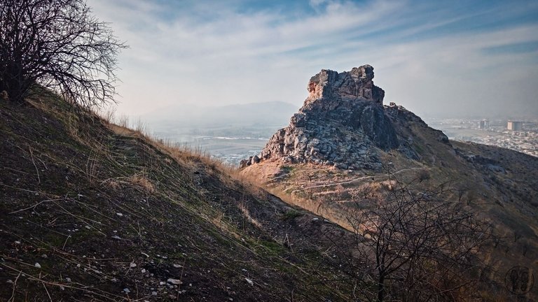
Osh is probably the oldest city in Kyrgyzstan and has historically been an important trading hub. It sits at the foot of Mount Solomon (Сулайман-тоо), a distinctive hill visible from far away, which has been a landmark for travelers in the valley for centuries. Sadly, there isn’t much left of the city’s ancient history. After WWII, the communists rebuilt the city, so today, the dominant architecture is more socialist realism and colonial-style rather than the traditional oriental design.
PL:
Dzisiaj chciałbym zaprezentować post na temat mojej podróży do Kirgistanu. Na wstępie chcę przeprosić za kiepskiej jakości zdjęcia, ale niestety ograniczenia bagażowe i fakt że podróż nie miała charakteru czysto turystyczno fotograficznego sprawiły że byłem skazany na robienie zdjęć kitowym obiektywem oraz telefonem.
Rejonem po którym poruszałem się podczas wyjazdu była dolina Fergańska znajdująca się w południowo zachodniej części Kirgistanu. Fergana otoczona jest górami, na północy pasmem Tien-Szan, natomiast na południu górami Ałajskimi. Dolina leży na terenie Kirgistanu, Uzbekistanu i Tadżykistanu. Już od starożytności był to rejon bardzo intensywnie użytkowany rolniczo i tak pozostało do dzisiaj i tak samo jak w starożytności dolina jest poprzecinana licznymi kanałami nawadniającymi które dostarczają wodę na pola. Uprawia się tutaj między innymi zboże, bawełnę oraz ryż.
Mam nadzieję, że udało mi się oddać na zdjęciach zróżnicowany krajobraz doliny, gdzie pola uprawne przechodzą w stepy, nad którymi górują ośnieżone szczyty gór. Chociaż niestety pogoda nie była zbyt łaskawa i przez wiele dni na stepie zalegała mgła i nisko zawieszone chmury, które skutecznie zasłaniały otaczające dolinę góry.
Największym ośrodkiem miejskim na obszarze doliny Fergańskiej w Kirgistanie jest miasto Osz, gdzie również udało mi się spędzić trochę czasu i chociaż nie przepadam za dużymi miastami to bardzo lubię atmosferę targów i bazarów, które się w nich znajdują. Pod tym względem Osz nie zawiodło, znajduje się tam sporych rozmiarów targowisko rozłożone po obu stronach rzeku Ak-Buury przepływającej przez środek miasta.
Osz jest także prawdopodobnie najstarszym miastem w Kirgistanie, stanowiło ważny punkt, gdzie krzyżowały się się szlaki handlowe oraz drogowskaz, poniewaz położone jest u podnóża Góry Salomona (Сулайман-тоо), charakterystycznego wzgórza, widocznego z daleka i stanowiącego punkt orientacyjny dla podróżujących po dolinie.
Niestety z historycznego miasta pozostało niewiele, po II wojnie światowej komuniści przebudowali miasto i dziś dominuje tam raczej socrealizm i kolonializm niż architektura orientalna.
PL:
Pola uprawne i widoczne szyty pasma Tien-Szan
ENG:
Farming fields with views of the Tien Shan mountain range
PL:
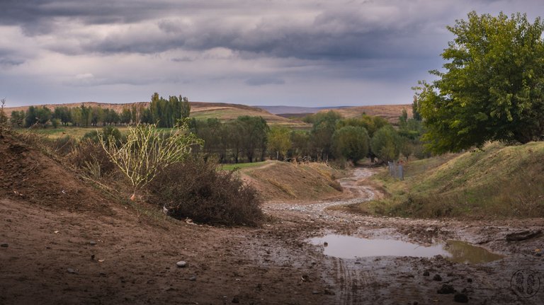
Krajobraz Fergańskiej doliny i jej otoczenia, pola, step i widoczne w oddali góry
ENG:
The landscape of the Fergana Valley and its surroundings, where fields and steppes stretch out with distant mountains in sight.
PL:
Wzgórza w okolicach Osz
ENG:
The hills around Osh
PL:
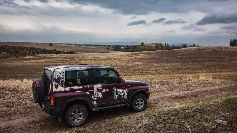
Podróż po stepie, tutaj auto 4x4 na prawdę się przydaje
ENG:
Traveling across the steppe—this is where a 4x4 vehicle really comes in handy
PL:
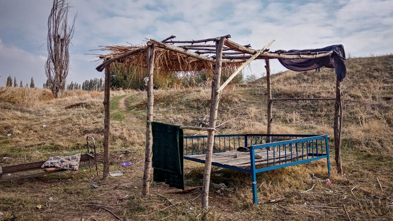
Miejsce odpoczynku i posiłku dla pasterzy napotkane gdzieś w stepie
ENG:
A resting spot and meal area for shepherds somewhere in the steppe
PL:
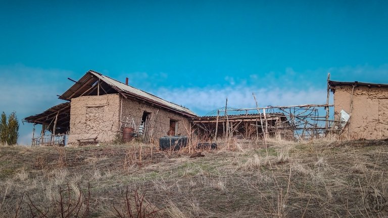
Wiejska zagroda z suszonej cegły
ENG:
A rural homestead made of mud brick
PL:
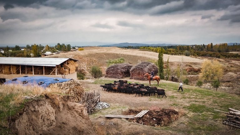
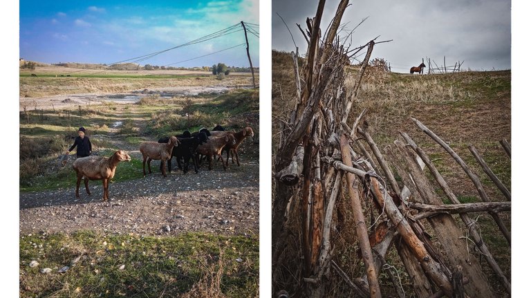
Bardzo powrzechne jest pasterstwo, na stepie i pośród pól wypasane są owce, krowy oraz konie.
ENG:
Shepherding is very common here, and sheep, cows and horses graze on the steppe and among the fields
PL:
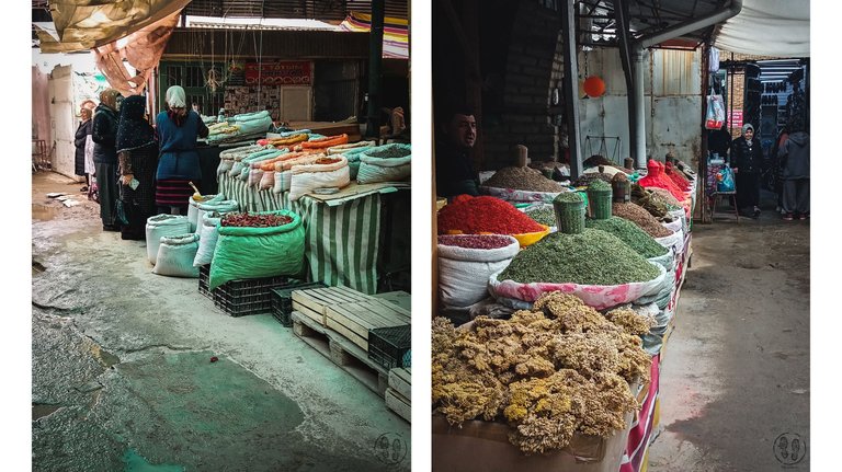
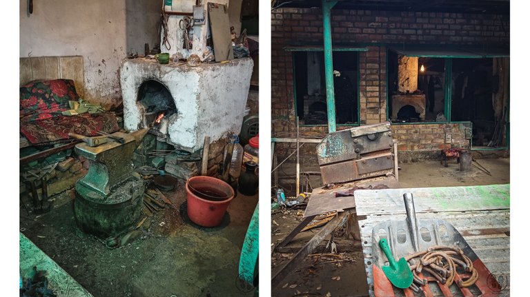
Targ w Osz podelony jest na "dzielnice" są sektory gdzie handluje się żywnością, przyprawami, mięsem, dla mnie najciekawszy był sektor gdzie swoje wyroby wykonywali i sprzedawali kowale
ENG:
The market in Osh is divided into "districts"—there are sections for food, spices, and meat, but for me, the most interesting part was the area where blacksmiths sold their handmade items.
Mam nadzieję, że relacja się podobała, Pozdrawiam!
I hope you enjoyed the story! Best regards!

